A River Runs Under It
Scientists drill beneath the seafloor for signs of fresh water.
Written by Brian Bushard
Images Courtesy of New England Shelf Hydrogeology
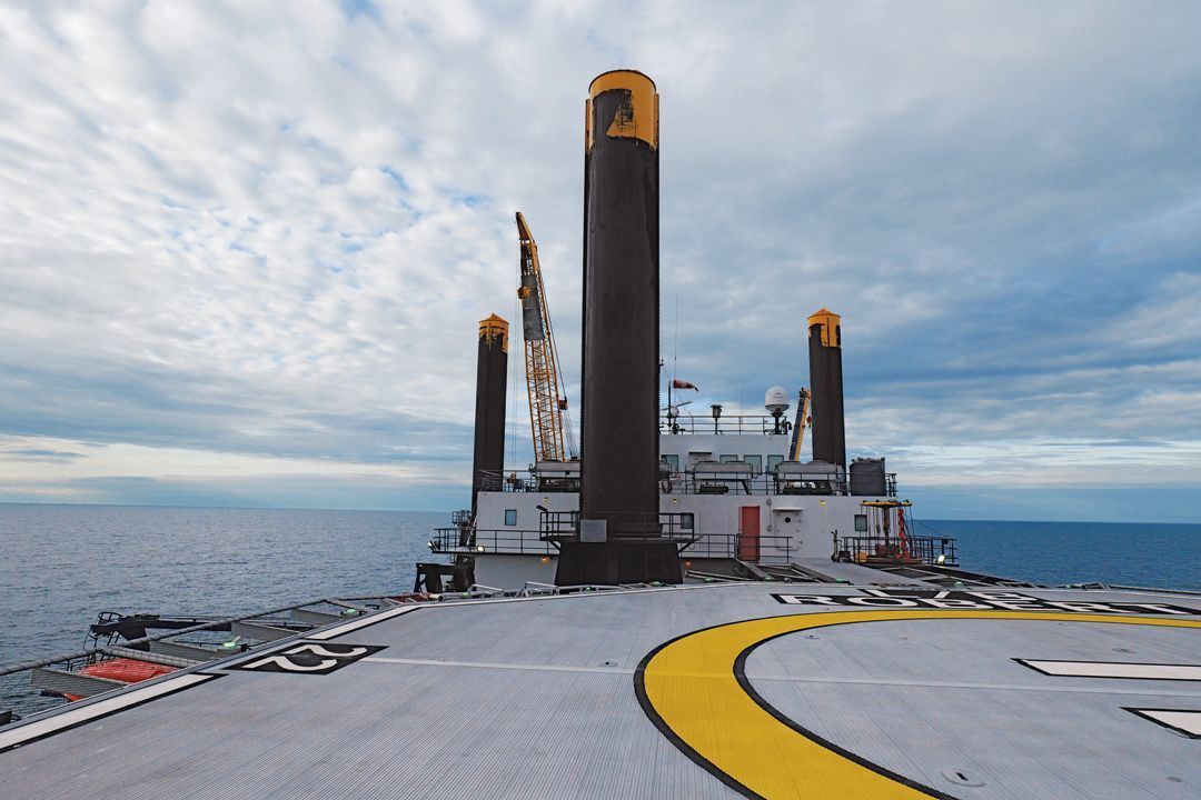
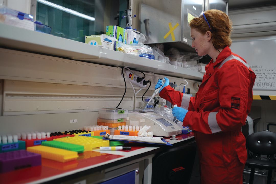
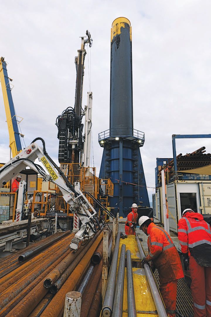
It might be the most unlikely place to search for drinking water. Twenty miles south of Nantucket, Jez Everest is stationed on a liftboat with no land in sight—only turbines and sharks. Everything about the project looks strange on the surface. Scientists are working in converted shipping containers on what looks like an oilrig propped above the surface. They’re drilling for signs of freshwater 400 meters beneath the seafloor. And on this day, those signs are clear as day.
“These projects don’t come up very often,” said Jez Everest, expedition project manager for the New England Shelf Hydrogeology Expedition. “This is something that’s never been done before, never been tried before and the results of it will be globally significant.”
In a way, the idea for the project is 50 years in the making. In the 1970s, a team of scientists with the U.S. Geological Survey led an offshore drilling project from Florida to New Hampshire in search of petroleum deposits. They didn’t find any, and the project fell dormant. But during that operation, they found traces of fresh water beneath the seafloor south of New England, a geological anomaly with massive implications as a potential source of fresh drinking water.
Since that drilling project ended, no follow-up testing has been conducted for the elusive freshwater system that scientists all but know lies deep beneath the seafloor—that is until now. “It was an exciting observation at the time, but not a lot of work was done with it because that wasn’t the project,” said Brandon Dugan, a professor of geophysics at the Colorado School of Mines in Golden, Colorado. Dugan is leading the drilling expedition this summer.

Dugan’s team of scientists is part of the New England Shelf Hydrogeology Expedition, which launched a three-month research operation in early May. The research group’s members represent 16 countries and will be stationed on the liftboat Robert, a 185-foot drilling vessel that looks like a fish out of water. The vessel rests entirely above the surface, with three legs tethered to the seafloor.
The $26 million project—funded by the International Ocean Drilling Programme and the U.S. National Science Foundation—works a lot like an ordinary oil drilling operation. From the liftboat, Dugan’s team drills up to 1,600 feet beneath the seafloor in three transects: at 19 miles, 26 miles and 42 miles south of Nantucket. Dugan hypothesizes freshwater may exist as far as 30 miles out. The question for researchers is not only how big that aquifer is, but how long the water has been there and how it got there.
Mark Willett has been asking those questions for two decades as an engineer and now as the director of Nantucket’s Wannacomet Water Company. Nantucket is fortunate to have its own sole-source aquifer that is not contaminated by groundwater inputs from any other areas. The only potential contamination to the aquifer would come from the island itself.
It turns out that about 250-280 feet below the island, there’s a glacial lake deposit about 100-feet thick, an area encased in clay that likely formed during the last ice age, when receding glaciers left behind the sediment that formed Cape Cod and the islands. “You’ll see a massive glacial lake deposit that’s solid clay, just like Play-Doh, completely impervious,” Willett said. “And below that is another freshwater lens, which we have not tapped into. Nobody has. I think with that glacial lake deposit, that could turn into a mining operation. There’s no recharge that’s going to get through that glacial deposit.”
That groundwater system extends past Nantucket’s shoreline. At low tide, Willett said you can see freshwater trickling onto some beaches up through the sand along Nantucket Harbor. “The birds are drinking the water,” Willett said. “Birds don’t drink salt water. So at low tide, we are actually losing water out of the aquifer into the ocean.” If that freshwater system stretches for miles and miles beyond Nantucket—as Dugan and his team believe—it could mean an untapped resource not only for Nantucket, but for the entire region. It could also mean other countries around the world with similar geological formations could have another source of water.

“This could be big for a lot of countries—like a National Geographic TV show big,” Willett said. “It’s the first group of scientists whose sole purpose is to go find the aquifer. They know it’s there. Now they’re going to locate it, find it and sample it to see that maybe it’s completely fresh.”
Dugan hopes the research project will provide answers for countries and regions where rainfall cannot be counted on for sufficient fresh water. He pointed to one case in Cape Town, South Africa, where in 2018 the city’s water supply dropped to just a trickle, sparking a regional water crisis. “A very populous, developed city was almost out of water and they limited people to five liters of water per day,” Dugan said. “There’s anecdotal evidence that an aquifer like this exists off South Africa. If we understand these systems better, policymakers can make informed decisions on protecting, maintaining, sustaining or using that water as they feel right. This is not isolated to New England; we just happen to know the most about it here.”
“When we understand the science in a place where we have the most information, we will know how to study these other places more effectively,” he continued. “What we do next is the big question. Then it’s up to policymakers to decide what they would like to do in terms of preserving this resource.


